Mar 30, 2014

Trekking & Road Trip in Norway - Day 11 (Back to Stockholm)

The last day was spent almost exclusively on driving from Oslo to Stockholm with a stop in Karlstad for a quick lunch. Eleven days of travel through unforgettable Norway sceneries and some of its fantastic mountains and Fjords. A travel I had wanted to go for several years and it was at least as I had expected. I am already thinking of another trip, when, I can't say. Here is the complete route of this road trip.

The complete road trip route, Start/end: Stockholm

Karlstad, Stora Torget
See a 360 VR panorama from this place here!

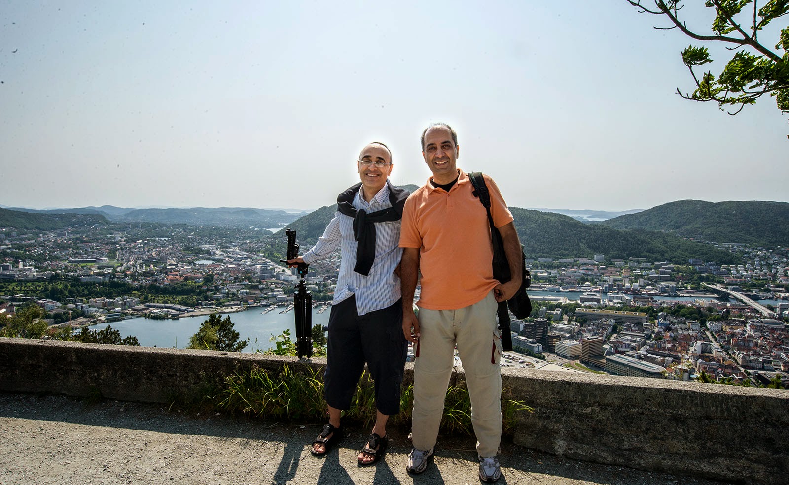
At last a few selfies I took during the trip, to see more images from the same places and many many more, please have a look at the previous posts in this blog and/or at the 360 degrees panoramas gallery at stockholm360.net's Norway gallery


View of Alesund from Aksla Fjellstua viewpoint
Nikon D600, Nikkor 16mm, 1/80s, f/8

On Ferry in Norddals Fjord
Nikon D600, Nikkor 18-35 @26mm, 1/250s, f/11

Trollstigen Road viewpoint
Nikon D600, Nikkor 18-35 @18mm, 1/80s, f/8

Viewpoint over The Geiranger Fjord
Nikon D600, Nikkor 18-35 @26mm, 1/100s, f/10

At the top of Dalsnibba with The Geiranger Fjord in the background
Nikon D600, Nikkor 18-35 @18mm, 1/100s, f/10

Jotunheimen National Park
Nikon D600, Tokina 10-17 @14mm, 1/60s, F/9

Off road Valldalen
Nikon D600, Nikkor 18-35 @18mm, 1/50s, f/8

Off road Valldalen
Nikon D600, Nikkor 18-35 @18mm, 1/50s, f/8


Trekking & Road Trip in Norway - Day 10 (Road to Oslo)

Time goes fast when you have fun. It takes me two days to get back home so I have to drive back towards Stockholm. This will be another route than the one I took when driving from Stockholm and I wanted to stop by in Oslo to say hello to a friend I had there. The first thing was off course another ferry over the another fjord.

See a 360 panorama from this place here!
Nikon D600, Nikkor 18-35 @18mm, f/11, 1/40s

Nikon D600, Nikkor 18-35 @18mm, f/14, 1/100s

Nikon D600, Nikkor 18-35 @21mm, f/14, 1/500s

Trekking & Road Trip in Norway - Day 9 (Stavanger & Preikestolen)

Drive towards another west coast town, Stavanger. To get there from Bergen requires that you take ferries twice, which means waiting, embarking, etc that takes a lot of time for the 205 km distance between the the two towns. In total it took 4,5 hours to get there.

Ferry 2 on the road between Bergen & Stavanger
Nikon D600, Nikkor 18-35@35mm, f/22, 1/400s

Ferry 1 on the road between Bergen & Stavanger
Nikon D600, Nikkor 18-35@21mm, f/22, 1/400s
Today has started well as it does not seem to be rainy. Just before noon I arrived in Stavanger and there was a huge Italian ship that also arrived the same time in the harbour with a lot of tourists. I thought these tourist will also aim to go to the same place as I had planned and it's better I get there before so that I can avoid the crowd while climbing. So I took a few shots and drove towards Preikestolen (The Pulpit Rock).

Stavanger
See a 360 degrees VR panorama from this place here!
Nikon D600, Nikkor 18-35@32mm, f/11, 1/4000s

Another 30 minutes of driving and yet another ferry an some more driving to the parking lot at the foot of the mountain. At the parking lot where the road ends you could see the sign warning how long it would take to hike up to the Pulpit Rock and how long to go back. You could read on the sign.

"Preikestolen (The Pulpit Rock) was most likely formed with the melting frost 10,000 years ago, just after the Lysefjord glacier melted. This flat mountain plateau protrudes approximately 30 m from the mountain side and gives you an amazing view over the fjord and the mountains.

Remember proper footwear, warm clothes, food and something to drink. 2 hours walk each way. Have a nice walk."

The sign at the prking lot
Samsung Galaxy S4 Smartphone

Well it took 1 hour an 45 minutes to walk/climb at times tough track to the Pulpit Rock. Well there I felt that it was worth it.

The Pulpit Rock (Preikestolen)
See a 360 degrees VR panorama from this place here!
Nikon D600, Sigma 75-300@75mm, f/11, 1/250s


The Pulpit Rock (Preikestolen)
See another 360 degrees VR panorama from this place here!
Nikon D600, Nikkor 18-35@35mm, f/11, 1/250s
On the way down I took another trail, which actually offered somewhat different and interesting views.

Trekking on the way dwon from the Pulpit Rock 
Nikon D600, Nikkor 18-35@18mm, f/10, 1/400s


See 360 degrees VR Panorama!
Nikon D600, Nikkor 18-35@35mm, f/10, 1/100s

Back to the car and continue on the road. It was getting dark and I was very tired after more than 8 hours driving and 5-6 hours of hiking. That was enough for one day.

Sunset at road away form the Pulpit rock
Nikon D600, Nikkor 18-35@30mm, f/8, 1/160s

Trekking & Road Trip in Norway - Day 7 & 8 (Bergen)

Well in Bergen I stayed at home to recover from the wet trekking and muscle pains a full day. The weather was not that fantastic either. On the eight day the sun showed herself alt last and I felt much better so we went to the explore Bergen a little.  So we walked in the town center and also we also went to take the Fløibanen Funicular. By taking the short ride with the Fløibanen Funicular from the city center to the top of the Fløien Mountain (320 meters above sea level), you have a golden opportunity to view the city, the mountains, the fjords and the sea.

We took a walk back through delightful scenery to go back down to the hustle and bustle of the Bergen Fish Market. 


Floiberget mount with Bargen in Background

Floiberget Mount with Part of Bergen and the See in the Background
See a 360 Degrees VR Panorama from This Place Here!

Sjofartsmonumentet
See a 360 Degrees VR Panorama from This Place Here!

Park in Bergen
See a 360 Degrees VR Panorama from This Place Here!


Mar 29, 2014

Trekking & Road Trip in Norway - Day 6 (Road to Bergen)

I woke up in Spiterstulen Mountain station, I had pain in all my body, the mountain walk in the cold rain yesterday didn't seem to had been a good idea and waiting here to wander about today wasn't appealing that morning. So, ate breakfast, started driving towards Bergen. Made a stop at a glacier where people were skiing, took some pictures. It was so cold and I felt extra cold as I was tired and with a T-shirt while people were had full winter outfit skiing. It is so strange, in 30 minutes you drive from the sea level with over 20 Celsius to this place at -10 Celsius. Off course you freeze. Just drive away...


30 minutes later I was in the valley with a lot better temperature.  

See a 360 VR panorama from this valley here!
A very attractive trail that I would dream to walk on but with all the pain everywhere in my body in both muscles and joints, I let it go just drove past. Hope I come back some other time.


I continued driving downwards, and drove through several tunnels and had to wait seveal times for the ferries to take me over the different fjords. It took a log of time waiting for ferries, embarking and driving off.


At last I reached Bergen. I had a friend there, to whom I went.

Trekking & Road Trip in Norway - Day 5 (Gejranger Fjord & Spiterstulen Mountain)

I didn't notice anything strange and actually had a nice sleep. The view was not too bad from the room and it was even better from the balcony where I had my breakfast on.

Here is the hotel in daylight in the morning

The hotel converted from a retirement home in daylight
See a 360 degree VR panorama from hotel balcony here!

View from the hotel room. 
Left the hotel and drove to another ferry to Geiranger. On our way we met another ferry also on its way to Geiranger, which is one of the most popular fjords in Norway because of its impressive dimensions and beauty.


Ferry to Geiranger,
See a 360 degrees VR panorama from the ferry here!

Geiranger fjord from Eagle eye viewpoint.
See 360 degrees VR panorama  here!
Geranger fjord from another viewpoint.
Still morning and I drove up the mountains to Dalsnibba, a 1476 m (4843 ft)  a mountain in Stranda Municipality in Møre og Romsdal county, Norway. Dalsnibba, at a height of 1476 m (4843 ft) over sea level, offers a fantastic and breath taking view. The Geiranger fjord is seen here 1476m lower down. The drive from Geiranger fjord at sea level to a height  of  4800 feet in just one hour or so is an experience.


Dalsnibba
See a 360 degrees VR panorama from the Dalsnibba here!

Lake on the way up to Dalsnibba

 After Dalsnibba to the town of Lom with a post Viking church with some viking characteristics.

Lom.
See a 360 degrees VR panorama from the Lom here!

Ate a late lunch in Lom and felt that the best half of the day is spent and I have not been on trekking today. So decided to head to Spiterstulen, a tourist station in the valley Visdalen in Lom in Oppland, which was nearby. Spiterstulen lies 1,100 metres above sea level, between the two highest mountains in Norway, Galdhøpiggen and Glittertind. It is the largest tourist cabin in Jotunheimen, with around 230 beds, and the furthest you can get with car, a start point for trekkers. Drove there, parked the car and hit a track towards the nature experience.


Spiterstulen Mountain
See a 360 degrees VR panorama from the place here!
Walked about two hours. It was cold, it wan very windy and guess what, it started raining again. I thought this cannot be true. As I was not equipped or prepared for very cold weather, I was freezing, and felt the feeling in my hands decreases as soon as I fiddle with camera. So, I decided to take some pictures and go back to the station. When I arrived I was cold and wet. Decided to stay over night there, sat inside looked at the rainy mountain outside through the window...

Spiterstulen Mountain Station

Trekking & Road Trip in Norway - Day 4 (The Great Views)

Waking up in the small cabin by the ray of sun coming through the small window. Got up and out of the cabin, the day was promising with as it was the first sunny day during the trip. 


The small red cabin.
See the 360 degree VR panorama here!

Had my breakfast on the cabin's porch and hit the road. For the first time took the ferry over to cross the Storfjorden, Beautiful.


On the Ferry crossing Storfjorden

On the other side, the ferry on its way back.
Continued on road up in the mountain to see the another magnificent view over Sunnyfjorden.


Sunnyfjorden.
See the 360 VR panorama here!

Soon after this view was time to take another ferry crossing the Sunny fjord (Sunnyfjorden) and Geirangerfjorden. There was much more clouds in the sky and it was not as blue as in the morning and it seemed the it was getting worse. I decided to not stop and continue to find a good track for trekking. Drove northwards to Norddal and then to Herdalssetra. Parked the car and hit the track. First a small gravel road to Herdalssetra, a Mountain Summer Farm and from there just a small track to the mountains. Now it was completely cloudy. 

On the gravel road.
See the 360 VR panorama here!
On the track.
See the 360 VR panorama here!
After three hours walking it started drizzling. I thought, maybe it is better to go back as the weather has been getting worse and worse during the day and there was a risk for the drizzle to go over to rain. Just a last image and head back to the car. 


It's getting worse, best to go back.
See the 360 VR panorama here!
The downhill walk was much faster and I got to the car before I was completely wet. It was almost dark so I tried to find a place to stay over night and found a very small homely hotel. Checked in and had the dinner there. During the dinner I learned that the hotel had been an old retirement home that had been converted to hotel, it had only ten rooms and I was one the only two guests for that night, spooky but interesting. After the dinner I went directly to sleep...